Thursday, December 25, 2008

Merry Christmas From St.Philip South DEO

Joy in the air... good cheer every where.

Christmas is a special time to remember those who are dear to us.

May the good tidings and warmth it brings be with you throughout the year.

Merry Christmas from the St. Philip South District Emergency Organisation.

Sunday, November 23, 2008

St. Philip South DEO Receives Donation

The Officers and members of the St. Philip South District Emergency Organisation are now closer to their goal of purchasing a much needed computer and multimedia projector.

Help has come from the team at Barbados Public Workers Co-operative Credit Union Six Roads Branch. The Credit Union has been operating in the Emerald City Supermarket complex since May of this year and has already become a welcome and productive member of the St. Philip South community.

St. Philip South D.E.O. member Henderson Linton expressed his gratitude to the credit union team at Six Roads saying, "We needed help to purchase the much needed equipment and we are blessed to have received this assistance."

The computer will be used mostly for data collection and the multimedia projector will be used as a teaching aid for community education and outreach.

There was also a call for residents of the community to get involved in the work of the D.E.O. not only during the huricane season but throughout the year.

Thursday, August 21, 2008

Invest 94L Approaching The Windward Islands


All eyes are looking eastward this afternoon as Invest 94L makes its way towards the Windward Islands. At 2:00 p.m. the area of disturbed weather was located 850 miles East of the Windward Islands near latitude 12.2 degrees North and longitude 48.8 degrees West.

Invest 94L with maximum sustained winds of 30 mph is moving towards the West at 17 mph. Shower activity associated with this area of low pressure is reported to be disorganised. However, forecasters are indicating there may be a chance of thunderstorms and also slow intensification of this system.

Sunday, August 10, 2008

DERT Training Programme Concludes


The District Emergency Response Team (DERT) training programme for District Emergency Organisations (DEO) officially ended yesterday at the Princess Margaret Secondary school, St. Philip. The pilot programme was designed to provide DEO members with the basics skills that they will need to respond to their community's immediate needs in the aftermath of a disaster when the emergency services are not immediately available.

The programme concluded with a simulation and assessment exercise yesterday, during the exercise facilitators were able to assess the effectiveness of the course. The participants operated under simulated emergency conditions and were evaluated on all six modules of the training programme. The District Emergency Response Team training course is expected to be extended to the other DEOs.

St. Philip South DEO - Meeting August 12, 2008

Members of the St. Philip South District Emergency Organisation are reminded of our monthly meeting on Tuesday, August 12, 2008 at the St. Martin's Mangrove Primary School, St. Martin, St. Philip at 8:00 p.m.

Members of the public with an interest in the District Emergency Organisation are also invited to attend. Please note that our major fund raising event takes place on Saturday, October 25, 2008.

Invest 92L Looming Off The Windward Islands


A tropical wave located near latitude 10.7 North and longitude 44.5 West has developed a modest amount of heavy thunderstorm activity overnight. Invest 92L is showing signs of development and is currently being tracked by the National Hurricane Center.

The environment around the tropical disturbance appears favorable for intensification, except for the dry air to the west. Forecasters are predicting that Invest 92L will take at least two days to get organized and form a tropical depression. The UKMET, GFS, and ECMWF models are indicating that 92L may become a weak tropical storm by the time the disturbance crosses into the northern Lesser Antilles Islands on Wednesday or Thursday.

The National Hurricane Center is giving 92L a medium (20-50% chance) of becoming a tropical depression by Tuesday morning. At 2:00 p.m. Invest 92L with maximum sustained winds of 30 mph was moving West at 18 mph. Residents and visitors to the Lesser Antilles should prepare for the possibility of tropical storm conditions arriving as early as Wednesday.

Sunday, July 27, 2008

St. Philip South DEO - Meeting July 30, 2008

Members of the St. Philip South District Emergency Organisation are reminded of a Special Meeting on Wednesday, July 30, 2008 at the St. Martin's Mangrove Primary School, St. Martin, St. Philip at 8:00 p.m.

A special invitation is extended to all members especially those who are officers of the various DEO sub committees. The aforementioned sub-committees are as follows; information, shelter, clothing, feeding, first aid, road clearance, damage assessment and communications.

The Guest Speaker will be Mr. Frankland Weekes of the Department of Emergency Management (DEM).

Sunday, July 20, 2008

Here Comes Tropical Storms Cristobal And Dolly


Hurricane forecasters are currently monitoring the progress of three storm systems. They are Tropical Storms Bertha, Cristobal and Dolly.
The National Hurricane Center has already issued its first advisory for the fourth tropical storm of the Atlantic Hurricane Season TS Dolly.

Tropical Storm Dolly is expected to affect the Yucatan Peninsula of Mexico from its border with Belize to the Bay of Campeche. A Storm Warning is currently in effect for these territories, this means that tropical storm conditions are expected within the next 24 hours.

At 11:45 a.m. the center of Tropical Storm Dolly was located near latitude 18.4 North and longitude 84.2 West or about 270 miles (435 km) East of Chetumal, Mexico. Dolly is moving towards the North-West near 17 mph (28 km/h), A North-Westward motion is forecast during the next couple of days.

Maximum sustained winds are near 45 mph (75 km/h) with higher gusts, slight strengthening is possible today. Tropical Storm force winds extend outward up to 175 miles from the center. The minimal central pressure is 1008 milibars.

An Intermediate Advisory will be issued by the National Hurricane Center at 2:00 p.m.

Saturday, July 19, 2008

DEO Personnel Undergo Sensitisation Training


A number of officers from the District Emergency Organisation (DEO) were recently exposed to sensitisation training. This is as a result of a training workshop sponsored by the Barbados Council for the Disabled at Harambee House, Garrison, St. Michael.

The training sought to heighten the awareness of disaster and emergency personnel with regard to planning for and addressing the needs of persons with disabilities. The participants were reminded of the need to incorporate people with disabilities in their disaster plans and also their responsibilities to the special needs groups.

Several challenges faced by vulnerable persons were highlighted during the workshop, one important fact arising from the discussions is the need to have greater involvement of disabled persons in the preplanning for disasters and emergencies.

Sunday, July 13, 2008

Tropical Disturbance - Invest 94L


A tropical disturbance (Invest 94L) in the Eastern Atlantic is currently being tracked by the National Hurricane Center and may be upgraded to a tropical depression.

At 8:00 a.m. the center of the tropical disturbance was estimated to be near latitude 8.9 North and longitude 37.2 West or about 1600 miles East of the Southern Windward Islands. Preliminary computer projections (most of them), track 94L mainly towards the West affecting the Southern Windwards in 4 - 5 days. Forecasters are predicting that it could reach hurricane status by day 3 based on the SHIPS forecast model. If it does further develop, Cristobal would be it's name.

Maximum sustained winds are near 25 mph, with some strengthening expected. The estimated minimum central pressure is 1008 millibars.

Increased Chance Of Rain

Residents in Barbados and the Eastern Caribbean should prepare for elevated levels of rain fall over the next couple of days as a weather disturbance approaches our area.

Forecasters are predicting an increased chance of rain over the next few days but as the disturbance moves away, rain chances will begin to decrease toward the middle of the week. There is a 50 percent chance for rain throughout our area today, with chances Monday holding at 40 percent.

According to the marine forecast, boaters can expect variable but moderate winds with higher winds and rougher sea conditions are expected near isolated showers and thunderstorms, which are predicted throughout the forecast period.

Sunday, July 6, 2008

Tropical Storm Bertha Forecast To Strengthen


Tropical Storm Bertha is briskly moving westward and is forecast to strengthen. Bertha's maximum sustained winds are near 50 mph (85 kph), and forecasters said it could gradually strengthen further over the next few days.

At 11:00 a.m. today the second tropical storm of the 2008 Atlantic Hurricane season was about 1185 miles east of the northern Leeward Islands and was moving west at about 21 mph (33 kph).

It was expected to proceed on a general west-northwest track with a gradual decrease in forward speed. As Bertha remains over the waters of the Central Tropical Atlantic it is much too early to determine if Bertha will eventually affect any land areas.

Some computer forecasting models predicted Bertha's top winds would reach the 74 mph (119 kph) threshold to become a hurricane in three or four days.

Thursday, July 3, 2008

St. Philip South DEO - Meeting July 8, 2008

Members of the St. Philip South District Emergency Organisation are reminded of our monthly meeting on Tuesday, July 8, 2008 at the St. Martin's Mangrove Primary School, St. Martin, St. Philip at 8:00 p.m.
Area Wardens, and other officers of the various DEO sub committees are especially asked to attend. The aforementioned sub-committees are as follows; information, shelter, clothing, feeding, first aid, road clearance, damage assessment and communications. A review of our readiness in each of these areas will be conducted.

Tropical Storm Bertha Is Born


Tropical Storm Bertha is born, according to the National Hurricane Center. The storm has sustained winds near 40 mph and was located off the coast of Africa, about 190 miles south-southeast of the Cape Verde Islands.

Bertha is the second storm of the 2008 Atlantic Hurricane season and is moving at about 14 mph. Forecasters say the storm doesn’t appear likely to become a hurricane, and should stay well away from the Caribbean island chain.

Tropical Depression 2 Forms In The Atlantic


The tropical disturbance in the eastern Atlantic has been upgraded to the second tropical depression of the 2008 Atlantic Hurricane season.

At 5:00 a.m. the center of tropical depression 2 was estimated to be near latitude 12.6 north and longitude 22.7 west or about 2,479 miles (3989 km) east of the Windward Islands. The depression is moving towards the west-northwest near 9 mph and this general motion with some increase in forward speed is expected for the next couple of days.

Maximum sustained winds are near 35 mph... 55 km/h with higher gusts. Some strengthening is forecast during the next 24 hours and the depression could become a tropical storm later today. The estimated minimum central pressure is 1008 millibars, residents in the eastern Caribbean should continue to monitor the progress of this system as it develops. An advisory will be issued by the National Hurricane Center at 11:00 a.m.

Tuesday, July 1, 2008

Strong Tropical Wave Off Cape Verde Islands


A strong tropical wave is off the coast of west Africa near the Cape Verde Islands along 17 degrees West and south of 19 degrees North. The wave is estimated to be moving westwards at 15 knots. A 1011 millibar surface low is situated along the axis near 11 degrees North... very near a recent burst of deep convection.

This wave is rather vigorous exhibiting a well defined cyclonic turning and scattered moderate convection within 240 nautical miles either side of the axis. This wave will be closely monitored for further development.

Issued by: National Hurricane Center - 205 p.m. Tuesday July 01 2008.

Wednesday, June 25, 2008

DEM Says DEOs To Change

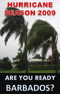
District Emergency Organisations were set up in Barbados, to fit into an international framework requiring communities to be the first response in case of emergency.

But according to Director of the Department of Emergency Management, Judy Thomas there is a perception that the DEOs have evolved into entities that run along constituencies lines and are seen as having political links... but the DEM head says that is about to change.

"I think that whatever emerges from this new assessment will be getting rid of that particular concept and putting it in a geographic setting that people are comfortable with."

According to her, the first step will be a consultation.

"We will establish a small technical working group, that will look at the strategizing for the way forward and out of that consultation we will put to the cabinet of Barbados a proposal for the establishment of a community preparedness vehicle which may not reflect what is in existence at this time."

Of the 30 DEOs that should be in existence, 26 are functioning at what has been described as a reasonable level. However the organisations in at least 4 St. Michael constituencies are said to be below satisfactory levels.

"Those are the ones in and around Saint Michael where we have great population, which are not functioning as such, because they don't even have chairpersons for those. There are others which have had recent changes of chairpersons and committees and so on, and I wouldn't want to use the word struggling, but they're not up and running as some of the others are running at this point in time."

Ms. Thomas says the question is not whether there will be a response, given the current state of the DEOs, but whether it will be appropriate, organised and systematic.

"A lot of people, when there is an emergency on, they come to offer their support the very day the thing is happening. You have so many people volunteering 'I want to do something, I want to do something.' The difficulty and the challenge John has is that people don't come forward when there's nothing happening and therefore that role of trying to achieve level of competency in the response is not there."

As such, Ms Thomas says the overhaul of the DEOs will see participation of the Boy Scouts, Girl Guides and the Youth Service among other groups.

Monday, June 23, 2008

Flood Awareness In St. Philip South


Residents within the constituency of St. Philip South who live in flood prone areas should take steps immediately to minimize property damage and personal risk. Start by being aware of your responsibilities, be mindful of local conditions and flood hazards in your area well before disaster strikes.

Although flooding can occur at any time of year, the most severe floods result seasonally from the influences of heavy rain, mainly during the hurricane season (June 1 to November 30). Persons living in close proximity to the sea shore must also give consideration to storm surge. The incidence of storm surge increases significantly during the hurricane season, rising water levels mean you may have to evacuate, listen to your radio for instructions outlining which roads are safe for travel.


Information on hurricane and flood preparedness can be obtained from the Department of Emergency Management or by contacting the St. Philip South District Emergency Organisation.

Friday, June 20, 2008

DEO Committee Members

St. Philip South District Emergency Organisation 2008 Committee


Chairman: Mr. Shelstone Lorde (246) 423-8124

Deputy Chairman: Mr. Haskell Carter (246) 416-5612

Secretary: Ms. Rochelle Lorde (246) 423-8128

Treasurer: Mrs. Eleen Agard (246) 416-5156

Assist Sec Treasurer: Mrs. Esther Larrier (246) 416-5226


Communications Officer: Mr. Glyne Alleyne (246) 423-3626

Feeding Officer: Ms. Veda Forde (246) 416-5312

Shelter Officer: Mr. Shirley Harewood (246) 423-6433

Damage Assessment Officer:

Clothing & Welfare Officer:

First Aid Officer: Ms. Verona Seale (246) 423-4641

About St. Philip South DEO

The St. Philip South District Emergency Organisation is one of 30 thirty DEOs which are established along the same boundaries as the Electoral Constituencies. DEOs are divided into five zones and are made up of executive committees and a number of Standing Committees whose functions relate closely to the Sectoral Standing Committees at the Department of Emergency Management (DEM). These committees are chaired by the officers outlined below:
  • Shelter Officer

  • First Aid Officer

  • Information & Damage Assessment Officer

  • Road Clearance & Transport Officer

  • Communications Officer

  • Clothing & Welfare Officer

  • Feeding Officer

The DEOs are operated by volunteers. Membership is drawn from the communities, which are served in the following ways:
  • Provide a forum for education and training at the community level
  • Develop operational plans and conduct pre-planning for emergency and disasters in the community
  • Develop a mechanism for initial emergency response to the community
  • Develop a mechanism to facilitate damage assessment, needs analysis, relief distribution.

Welcome to St. Philip South DEO online

Hello, welcome to the St. Philip South District Emergency Organisation's blog. The District Emergency Organisation (DEO) is the volunteer arm of the Department of Emergency Management in Barbados.

We hope that this new blog will provide an interactive medium for DEO members and the public as well. You are invited to submit your comments or suggestions for the blog. In addition, you can request information from the St. Philip South DEO.

We hope you enjoy our blog. Be sure to tell all your friends about this great new service!