Saturday, August 15, 2009

Northern Caribbean On Alert As Tropical Storm Ana Forms

The first tropical storm of the 2009 Atlantic Hurricane Season has formed and could impact on several islands in the north-east Caribbean by early next week.

The National Hurricane Centre says a tropical storm watch may be required for parts of the Leeward Islands on Saturday.

On its current course, TS Ana is forecast to pass uncomfortably close to or make landfall on Anguilla, Tortola and Grand Turk in the Turks and Caicos Islands early next week.

On the current path - based on the 5am EST 15 August 2009 forecast - the centre of Tropical Storm Ana is expected to pass 33 miles east of Antigua and six miles east of Anguilla on Monday morning. On Monday night the track takes it 10 miles east of Tortola in the British Virgin Islands and within 24 hours, 6 miles east of Grand Turk in the Turks and Caicos Islands.

These projections are subject to change with subsequent forecasts. The margin of error for a two-day forecast is 164 miles while for for 24 hours it is 89 miles.

At 5am EST, the centre of Tropical Storm Ana was estimated to be near 14.6 north and 46.8 west oo 1010 miles east of the Lesser Antilles.

It is travelling at 16mph towards the west and has a minimum central pressure of 1005MB. with maximum sustained winds of 40mph with higher gusts. Minimum central pressure of 1005MB.

Tropical storm force winds extend outward from the centre up to 70 miles.

The NHC says the environment is more conducive to strengthening and slow intensification is expected during the next 48 hours.

TS Ana was upgraded from Tropical Depression 2 which re-generated on Friday - one day after it was downgraded to an open tropical wave.

Source: www.caribbean360.com

Tuesday, August 11, 2009

Tropical Depression Forms - Expected To Strengthen

A tropical depression has formed in the eastern Atlantic Ocean and poses no threat to the Caribbean at this time.

The National Hurricane Centre (NHC) says it should strenghten in another 24 hours to become tropical storm as it continues westward for about two to three days when it should gradually turn towards the northwest as it navigates its way around the periphery of a high pressure system.

Beyond this, forecasters are uncertain.

Hurricane specialist Dr Richard Pasch says that the cyclone is currently situated over marginally warm ocean waters with weak upper level winds (warm water and weak shear are good ingredients for strengthening).

"The official forecast shows gradual strenghening over the next couple of days and is a blend of the various numerical guidance tools. As usual there is considerable uncertainty as to the strength of this system later in the forecast period. If the cyclone moves farther north than anticipated (in the current forecast) it will probably encounter stronger shear and not intensify as much as forecast. On the other hand if the system moves farther south than expected late in the (forecast) period...it will probably become stronger than anticipated...," says Pasch.

The current forecast track is for this system to curve northwest before reaching the Caribbean islands by weekend. However, that forecast is subject to change.

At 6am Eastern Standard Time, the centre of Tropical Depression Two was estimated to be near 14.4 north and 28.6 west with maximum sustained winds of 30mph, travelling towards the west at 13mph. The minimum central pressure is 1006MB.

Source: www.caribbean360.com

Friday, July 24, 2009

Hurricane Season Start Is Slow, But We're Not Off Hook

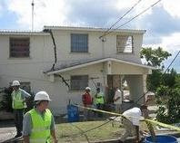
One year after Hurricane Dolly struck South Texas and became the Rio Grande Valley's most destructive storm in four decades, the tropics are decidedly quieter.

In fact the Atlantic basin has not gone this deep into hurricane season without a named storm in five years.

Add to that a maturing El Niño in the Pacific Ocean, which creates more wind shear over the Atlantic tropics and tends to depress storm activity by 20 to 40 percent, and the outlook for the rest of the 2009 season looks downright rosy.

But don't get too cocky, forecasters say.

Although the first Atlantic named storm typically forms by July 10, the real activity doesn't usually begin until August, and a lull in early season activity doesn't necessarily presage a weak overall season.

The 2004 season, for example, didn't see its first storm until Hurricane Alex began developing on July 31.

Yet after Alex the season rapidly ramped up, finishing with 15 storms and 6 major hurricanes, including Hurricane Ivan. A storm the size of Texas, Ivan was one of the 10 most intense hurricanes ever in the Atlantic basin before striking Gulf Shores, Ala., and causing $19 billion in damage.

El Niños'intensity
And while El Niños may suppress overall activity, such years can still produce savage storms. One of the three most-intense storms at a U.S. landfall, Hurricane Andrew, developed during an El Niño in 1992.

So have some of the most famed storms ever to strike Texas and Louisiana: Alicia (1983), Betsy (1965) and the great storm of 1900, which came during a severe El Niño, said Jill Hasling, president of Houston's Weather Research Center.

“There might be fewer storms during an El Niño,” she said. “But it only takes one.”

During an average Atlantic season, 10 tropical storms or hurricanes develop, but since 1995 the Atlantic has seen an upswing in activity that most scientists attribute to a long-term natural pattern.

Given this season's slow start and the onset of El Niño, most seasonal forecasters now say about 10 named storms will form, one of the lowest totals of the past 15 years.

Hostile July for storms
The official beginning of hurricane season came on June 1, but recent years have seen storms form in May.

This happens when frontal boundaries drift south into the Gulf of Mexico or off the East Coast, producing lingering areas of thunderstorms that sometimes spin into tropical storms, said Chris Hebert, lead hurricane meteorologist at ImpactWeather, a private Houston-based forecasting company.

That almost happened this year.

“We did have a few such features in May and June,” he said. “One made it to tropical depression strength, but none made it to tropical storm strength. So it was pretty close in May and June.”

But as often happens in July — and certainly what has happened this year, with all the heat — high pressure builds across the Gulf and Southeastern United States, reducing the chances of development near the United States.

July storms often form in the Caribbean at this time of year, but wind shear and other factors there have combined to create hostile conditions for storms, Hebert said.

The Bermuda High
Looking later into the season, Hebert says a semi-permanent feature called the Bermuda High, a large area of high pressure just north of the tropics, may be quite strong this year.

This would limit development in the deep tropics.

Perhaps, then, as hurricane season progresses storms will be most likely to develop closer to land in the Caribbean Sea or Gulf of Mexico, he said.

In fact, Hebert and other forecasters say such a possibility should concern emergency management experts because these storms give little warning.

Hurricane Alicia may have been bad, spinning up from a tropical depression on Aug. 15, 1983, into a Category 3 hurricane just two days later before striking Galveston, but there are worse precedents during an El Niño year.

Specifically, there's the largely forgotten Texas hurricane of 1932. That storm formed on Aug. 11 in the Gulf near the Yucatan Peninsula.

A day and a half later, a Category 4 hurricane, with 145-mph winds, slammed into Freeport.

Source: www.chron.com

Saturday, July 18, 2009

NHC Tracking Invest 97-L In The Atlantic

A tropical wave located near latitude 11.9 North and longitude 41.8 West has been designated Invest 97-L and is currently being tracked by the National Hurricane Center.

The National Hurricane Center is giving 97-L a low (less than 30%) chance of becoming a tropical depression during the next 48 hours. At 8:00 a.m. Invest 97-L with maximum sustained winds of 20 mph was moving Westward at 15 - 20 mph and is approximately 1200 miles East of the Windward Islands.

Saturday, June 6, 2009

St. Philip South DEO - Meeting June 9, 2009

Members of the St. Philip South District Emergency Organisation are reminded of our monthly meeting on Tuesday, June 9, 2009 at the St. Martin's Mangrove Primary School, St. Martin, St. Philip at 8:00 p.m.

Members of the public with an interest in the District Emergency Organisation are also invited to attend.

Friday, May 29, 2009

Season's First Tropical Depression Forms In Atlantic

The first tropical depression of the north Atlantic's hurricane season formed Thursday and forecasters said it would likely reach tropical storm strength before petering out over open seas.

"The depression is forecast to become a tropical storm over the next day or so, but then is expected to weaken or dissipate over colder waters by Saturday," the National Hurricane Center said.

At 1500 GMT the depression was located about 500 km (311 miles) south of Providence, Rhode Island or 1,020 kilometers (634 miles) southwest of Halifax, Nova Scotia.

The depression formed even before the official June 1 start of the Atlantic hurricane season, which stretches though November 30.

Wednesday, May 27, 2009

St Philip South DEO Annual Church Service

The annual Church Service of the St. Philip South District Emergency Organisation is scheduled to take place on Sunday, June 7, 2009 at the Kirton's New Testament Church.

The Service will commence at 9.00 a.m., members are asked to make a special effort to attend.

Monday, May 25, 2009

Mild Earthquake Recorded In Barbados


USGS, USA: Seismometers of the US Geological Survey recorded an earthquake of magnitude 4.7 on the Richter Scale at a depth of 12 miles approximately 55 miles ENE of Bridgetown, the capital of Barbados, early Sunday morning (01:13 A.M. Local - 05:13 UTC).

http://earthquake.usgs.gov/eqcenter/recenteqsww/Quakes/us2009haau.php

Friday, May 15, 2009

Names Of Deadly 2008 Hurricanes Retired

The names Gustav, Ike and Paloma will never be associated with future hurricanes or tropical storms on account of their deadly romp through the Caribbean last year, the United States National Oceanic and Atmospheric Administration (NOAA) has announced.

The storms claimed more than 200 lives and left a trail of destruction calculated in the billions across the region from August to November 2008.

Under the normal six-year rotation, the names would have been up to be used again in 2014. However, they will be replaced by Gonzalo, Isaias and Paulette.

A NOAA spokesman said the names were retired for reasons of sensitivity.

"That's why you'll never hear the name Katrina again or Andrew, for that matter. It would be very inappropriate," Dennis Feltgen said on Friday.

Hurricane Gustav slammed into Haiti as a Category One hurricane in August, killing 77 people before tearing into Cuba as a powerful Category Four system.

More than 80 people were killed as a result of Hurricane Ike in the Caribbean. The Turks and Caicos Islands, the Southeastern Bahamas and Cuba were among the worst impacted.

The Cuban government said Paloma, which became the second strongest November hurricane on record, reaching Category 4 destroyed more than 1,400 homes and causing about US$300 million in damage on the island.

Sunday, May 10, 2009

St. Philip South DEO - Meeting May 12, 2009

Members of the St. Philip South District Emergency Organisation are reminded of our monthly meeting on Tuesday, May 12, 2009 at the St. Martin's Mangrove Primary School, St. Martin, St. Philip at 8:00 p.m.

Members of the public with an interest in the District Emergency Organisation are also invited to attend.

Gray Predicts Average 2009 Hurricane Season

Predictions released by Colorado State University’s of leading forecaster, Professor William Gray, calls for an average hurricane season in 2009. A press statement issued by Professor Gray and his team said that based on the potential for a weak El Nino event and an observed cooling of tropical Atlantic sea surface temperatures, the number of hurricanes developing in 2009 would decrease.

Gray indicates that this hurricane season will be an average season with six hurricanes developing; with the risk that a major hurricane making landfall in the Caribbean is average as well. The forecasters said there would be a total of 12 named storms, including six hurricanes. Of those hurricanes, two are expected to develop into at least Category Three strength, or higher.

In 2008, there were 16 named storms including eight hurricanes, five of them were major.

Professor Gray, who is beginning his 26th year forecasting hurricanes at Colorado State University said; "We expect current weak La Nina conditions to transition to neutral and perhaps weak El Nino conditions by this year's hurricane season. If El Nino conditions develop for this year's hurricane season, it would tend to increase levels of vertical wind shear and decrease levels of Atlantic hurricane activity."

Professor Gray and his team also mentioned that they have seen uncharacteristic cooling of sea surface temperatures in the tropical Atlantic over the past few months. These cooler waters are associated with dynamic and thermodynamic factors that are less conducive for an active Atlantic hurricane season. Those factors are similar to conditions that occurred during 1951, 1968, 1976, 1985 and 2001 seasons. On average, those five seasons had average activity, and Gray and lead forecaster Phil Klotzbach predict the 2009 season will have activity in line with those years.

Thursday, April 30, 2009

Barbados Is On High Alert For Swine Flu

BARBADOS is on high alert for swine flu! While there were no known cases here up to yesterday afternoon, health authorities announced the implementation of a national action plan to mitigate the deadly virus that has claimed several lives in Mexico and spread to other countries including two of Barbados’ key tourist markets – the United States and Canada.
Officials were also monitoring the situation with two local sports teams – football and polo – who are set to return from Mexico “in the near future”, indicating they would have to report to port health officials on their arrival back home.

The island’s heightened state of action was announced by Minister of Health, Donville Inniss, and Chief Medical Officer (CMO), Dr. Joy St. John, following an emergency meeting of all major public sector agencies and some private bodies at the Pan-American Health Organisation’s Dayrell’s Road, Christ Church headquarters.

Key provisions of the national plan, influenced by the World Health Organisation’s decision to deem the current swine flu outbreak “a public health emergency of international concern” included:

• heightened surveillance at all ports of entry in Barbados including the Grantley Adams International Airport and Bridgetown Port and well as the Ministry of Health’s laboratory.

• declarations to port health personnel by all people entering Barbados from Mexico and other infected places within the last week to 10 days.

• circulation of guidelines on diagnosis and treatment to all private doctors.

• careful management of the island’s limited supplies of the anti-viral using Tamiflu.

• polyclinics will be the first line of treatment for mild cases including those of tourists.

The swine flu virus refers to influenza cases that are caused by Orthomyxoviruses that are endemic to pig populations. Symptoms are similar to those of other strains of human flu, including fever, cough, sore throat, body aches, headache, chills and fatigue, while diarrhoea and vomiting can also occur.

Inniss said urged all members of the public to immediately adopt precautionary measures recommended by the experts including frequent hand washing with soap and water, covering the mouth and nose with tissue when sneezing or coughing and seeking urgent medical attention if they have the stated symptoms.

“Government is working assiduously to effectively manage the situation as we know it at this time, and we will continue to work collectively to implement our plan of action to protect the health of Barbadians. We will keep monitoring the international events and update the public as the situation unfolds,” the minister said.

St. John said while the WHO had not declared a pandemic authorities needed to be on alert, especially since “this virus is not like any other that we have had in the world before.”

“Suffice it to say that we want to make it clear to the general population that we are going to keep abreast of current events and we are going to communicate to them frequently about their involvement because it’s not just the ministries and different agencies that have to respond,” she said.

“There has to be responsibility on the part of the general public and that’s why it is important if there have travelled that they declare, it is important that wherever they travelled to that they exhibit the precautions of hand washing, alcohol gels are also useful.”

The CMO made it clear Barbadians who were inoculated with the seasonal influenza vaccine were not protected from swine flu.

She also said currently there was vaccination offering protection from the current virus, adding that the drugs Tamiflu, of which Barbados had a supply from Cricket World Cup, and Relenza were successfully treating cases of the illness.

“We are going to be using these judiciously. We are not in a position where we need to use them as profolaxis for front line workers and I am not just talking medical staff, the front-line workers are well know to us because we have been generally immunising them as needs to be,” she noted.

“We are keeping a close eye on developing events when that is necessary we will inform the general public very specifically of who, when and where we will be employing of our very precious stocks of Tamiflu.”

Source: www.barbadosadvocate.com

Monday, January 12, 2009

More Emergency Drills Needed In Schools

Chief Education Officer, Dr. Wendy Griffith Watson has called for more emergency drills in schools.

Dr. Griffith-Watson, who is also chief shelter warden, was speaking against the background of several floods across Barbados last year, some of which impacted schools.

She believes frequent drills will help staff and students to be better prepared for any recurrence of the floods and other emergency situations.

"I would like the Red Cross and the District's Emergency Officers to help us arrange emergency drills at our schools throughout the school year. So that it becomes a normal practice and children then too are aware of their duties and responsibilities and parents will feel a little more assured that if something happens their children and the teachers are safe."

Source: www.cbc.bb

DEM Says There Are Too Few Emergency Shelters

The Department of Emergency Management is preparing to launch a comprehensive assessment of the emergency shelters across the island.

Director, Judy Thomas made the announcement while addressing the third in a series of training workshops for emergency shelter managers at the Ministry of Education's conference room

Ms Thomas has outlined several initiatives earmarked for 2009.

Among these is a structural assessment of the emergency shelters across the island, which she says will look at the integrity of the buildings.

"It will help the Ministry of Education to decide what is the most efficient part of the school to allocate as shelters because we are running very short of shelter capacity at the national level and we have to bring on board for more classrooms.'

Ms. Thomas told the workshop, comprising several shelter wardens and other emergency management partners, the department was working on special programme for the schools.

That initiative will see special disaster units set up and run by the students themselves.

"Once they know that their school is going to be a shelter and that is so promoted the children should gang together and ensure the windows are not broken, taps are not broken, water units in the bathrooms are secure and to ensure that their peers also help to keep these things in place."

Ms. Thomas says despite concerns voiced, principals who run the schools on a daily basis are better placed to transform the buildings for emergency situations.

The DEM director says the department is mindful that teachers, who will be responsible for the school based shelters, will need help in the event in an emergency and is urging the community around the schools to get involved.

"We realize that the Department of Emergency Management will never get the kinds of people in it to run all the important sectors and therefore there has to be a serious decentralization of some of the key tasks that are given to us."

She says the department plans to re-launch the Adopt a Shelter programme, which in its new format will allow non-governmental organisation and other international agencies to assist with their development.

Source: www.cbc.bb

Thursday, January 1, 2009

Happy New Year From St. Philip South DEO

Here's wishing each new day brings for you...


happiness, prosperity and continued success!


Happy New Year from the St. Philip South


District Emergency Organisation.