Thursday, August 21, 2008

Invest 94L Approaching The Windward Islands


All eyes are looking eastward this afternoon as Invest 94L makes its way towards the Windward Islands. At 2:00 p.m. the area of disturbed weather was located 850 miles East of the Windward Islands near latitude 12.2 degrees North and longitude 48.8 degrees West.

Invest 94L with maximum sustained winds of 30 mph is moving towards the West at 17 mph. Shower activity associated with this area of low pressure is reported to be disorganised. However, forecasters are indicating there may be a chance of thunderstorms and also slow intensification of this system.

Sunday, August 10, 2008

DERT Training Programme Concludes


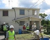
The District Emergency Response Team (DERT) training programme for District Emergency Organisations (DEO) officially ended yesterday at the Princess Margaret Secondary school, St. Philip. The pilot programme was designed to provide DEO members with the basics skills that they will need to respond to their community's immediate needs in the aftermath of a disaster when the emergency services are not immediately available.

The programme concluded with a simulation and assessment exercise yesterday, during the exercise facilitators were able to assess the effectiveness of the course. The participants operated under simulated emergency conditions and were evaluated on all six modules of the training programme. The District Emergency Response Team training course is expected to be extended to the other DEOs.

St. Philip South DEO - Meeting August 12, 2008

Members of the St. Philip South District Emergency Organisation are reminded of our monthly meeting on Tuesday, August 12, 2008 at the St. Martin's Mangrove Primary School, St. Martin, St. Philip at 8:00 p.m.

Members of the public with an interest in the District Emergency Organisation are also invited to attend. Please note that our major fund raising event takes place on Saturday, October 25, 2008.

Invest 92L Looming Off The Windward Islands


A tropical wave located near latitude 10.7 North and longitude 44.5 West has developed a modest amount of heavy thunderstorm activity overnight. Invest 92L is showing signs of development and is currently being tracked by the National Hurricane Center.

The environment around the tropical disturbance appears favorable for intensification, except for the dry air to the west. Forecasters are predicting that Invest 92L will take at least two days to get organized and form a tropical depression. The UKMET, GFS, and ECMWF models are indicating that 92L may become a weak tropical storm by the time the disturbance crosses into the northern Lesser Antilles Islands on Wednesday or Thursday.

The National Hurricane Center is giving 92L a medium (20-50% chance) of becoming a tropical depression by Tuesday morning. At 2:00 p.m. Invest 92L with maximum sustained winds of 30 mph was moving West at 18 mph. Residents and visitors to the Lesser Antilles should prepare for the possibility of tropical storm conditions arriving as early as Wednesday.